I90 South Dakota / Black Hills Raptor friendly trails?

Disclaimer: Links on this page pointing to Amazon, eBay and other sites may include affiliate code. If you click them and make a purchase, we may earn a small commission.

buyfire

Full Access Member
Joined
Oct 25, 2014
Posts
120
Reaction score
74
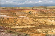
Taking a mini vaca across South Dakota in the next few weeks and I'd like to take part of a day stretching the Raptor's legs. Anyone know of any good sandy/desert type trails close to I90? I'd love to possibly get a little air under the tires, not so interested in deep woods type exploration. Thanks.
 

windsor

Active Member
Joined
Jan 28, 2012
Posts
72
Reaction score
33
Location
south dakota

I was told of this place and was recommended by several people. NEVER been there. Close to the badlands.

Then in the Black Hills, there is all kinds of trails. To many to list. If you go to https://www.fs.usda.gov/activity/blackhills/recreation/ohv/?recid=25823&actid=93
they have all the trails listed. Plus can down load trails to GPS.

Then by the Pierre area is all kinds of trails in Buffalo gap national grass lands. Not very scenic, but can put the pedal to the floor and go as fast as you can handle. Can not find the website for that one.

Hope this helps.
 

wheelman55

Full Access Member
Joined
Feb 4, 2016
Posts
927
Reaction score
485
Location
Big Bend or MN
If you have a little bit of time, take Hwy 44 across Dakota. It is south of I90 and more or less runs parallel. It is very scenic, with little traffic.

From Sioux Falls go south on I29 a few miles and exit west at 276th Street. Go west and you’ll end up on Hwy 44. Or access Hwy 44 by dropping south from Mitchell, SD. Either way will get you to Hwy 44.

44 takes you to “Interior” SD at the eastern edge of the Badlands. South and west of Interior you can find BIA roads, which are dirt/gravel. Make sure to have a good spare as these roads are remote with little traffic.

From Hill City, SD (Black Hills) you can take Deerfield Road/West Deerfield Road across to WY. These are Forest Service roads. Also very scenic. Once in Wyoming take a side trip to Devil‘s Tower.

Forest Service maps are available which will show the roads in the Black Hills. I think that the BIA roads in the reservation are listed in the Gazeeter maps. The roads also show up on the iPhone map app, and probably on Android.

Enjoy the trip!
 

Bracamonte

Full Access Member
Joined
Mar 16, 2021
Posts
247
Reaction score
451
Location
North Texas / Colorado / Black Hills
Sandy/desert type trails are not really the hallmark of the Black Hills. ;)

I too would suggest 44 on east side of the Black Hills, and all the way down to Hot Springs/Buffalo Gap. Will be open prairie and you may find more trails around Buffalo Gap and Hot Springs. In between that and Rapid City may be hard as its the edge of Custer State Park and Wind Cave National Park.

Also, take a look at Blackhawk area west of Rapid City off of I90.
 
Top